November 14, 2026
What a Construction Drone Report Should Contain for Better Project Decisions
By @aerialfieldnotes
Understanding the role of a drone report in construction
A construction drone report is a structured document generated from aerial data collected by drones. It provides stakeholders with visual and quantitative insights into a project's progress, site conditions, and potential issues. At its core, a good report answers the key questions that project managers, engineers, and clients need to know: Is the project on schedule? Are there unexpected problems? What does the site look like now compared to last week?
The value of a drone report depends entirely on what it contains. A report that simply presents raw images or a single orthomosaic without context is not very useful. Instead, a well-designed report should organize data in a way that supports decision-making. This is where a drone data platform becomes essential. Such a platform allows users to upload, process, and share data, turning raw aerial captures into actionable reports that can be compared over time.
For construction professionals, the report typically includes several standard components. These components are not just nice-to-have; they are the foundation for effective communication across the project team. When every stakeholder sees the same data in the same format, misunderstandings decrease and decisions become faster.
The essential components of a construction drone report
1. Orthomosaic and elevation models
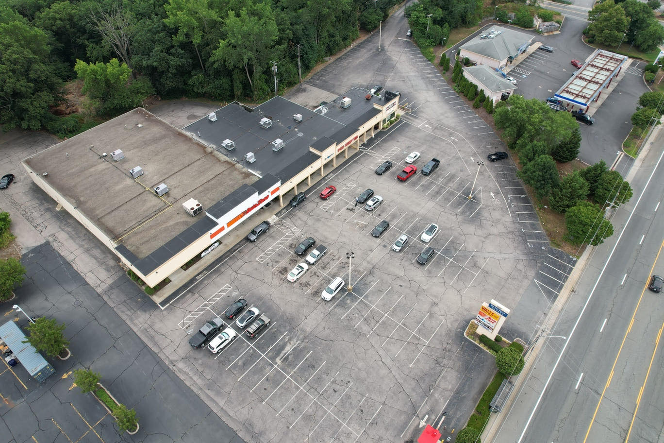
The most fundamental element is a high-resolution orthomosaic image. This is a geometrically corrected aerial image that serves as a true-to-scale map of the site. Without it, you cannot accurately measure distances, areas, or volumes. Alongside the orthomosaic, a digital elevation model (DEM) or digital surface model (DSM) provides height information. These models allow you to calculate cut and fill volumes for earthworks, monitor stockpile sizes, and track changes in terrain over time.
2. Volumetric calculations and measurements
One of the most common uses for drone data in construction is measuring stockpiles of materials like gravel, sand, or topsoil. A good report should include precise volumetric calculations for each stockpile, ideally with a comparison to previous surveys. The report should also show the location of each stockpile on the orthomosaic so that everyone knows exactly which pile the numbers refer to. Similarly, for earthmoving projects, the report should show the net volume of material moved and any discrepancies from the planned grade.
3. Progress tracking and time-series comparisons
A single report is useful, but a series of reports over time is far more valuable. A construction drone report should include a comparison with previous surveys. This can be done through overlays, side-by-side images, or change detection maps that highlight areas where material has been added or removed. For example, a color-coded map showing elevation changes between two dates quickly reveals where work is progressing and where it is lagging. This time-series data helps project managers identify trends and adjust schedules before small delays become big problems.
4. Annotations and issue flags
Raw data is only part of the story. A good report includes annotations that draw attention to specific features or potential issues. These annotations might mark areas of standing water, cracks in pavement, incomplete grading, or debris that needs removal. They can also highlight completed work for sign-off. Annotations should be clear, concise, and include a date and responsible party if possible. When these notes are embedded in the report, they prevent the need for separate emails or phone calls that can be overlooked.
5. Site safety and compliance notes
Construction sites are dynamic and often hazardous environments. A drone report can document safety conditions such as the presence of open trenches, unsecured materials, or blocked access routes. It can also serve as a record for compliance purposes, showing that the site was inspected on a certain date and that safety measures were in place. While the report itself is not a safety inspection, it provides visual evidence that can be valuable for insurance or regulatory purposes.
How a drone data platform enhances reporting
Creating a comprehensive report manually from drone footage is time-consuming. A drone data platform automates much of the processing, from stitching images into orthomosaics to generating elevation models and calculating volumes. The platform also organizes data in a way that makes it easy to compare surveys over time. Instead of digging through folders of images, users can access a timeline of reports for any given project.
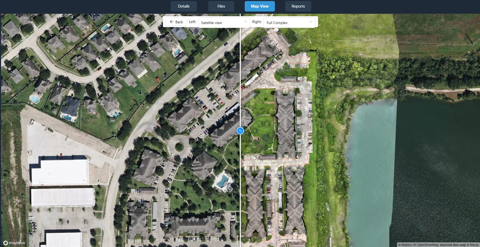
For example, a platform like nationaldroneservices.net provides tools for uploading, processing, organizing, visualizing, comparing, measuring, and sharing drone aerial data. This means that once a flight is completed, the data can be uploaded and processed into a report in a matter of hours, not days. The platform also supports collaborative features, allowing multiple team members to view and annotate the same report without having to be in the same office.
Another advantage of using a dedicated platform is consistency. Every report generated through the same platform follows the same structure and uses the same measurement standards. This makes it much easier to compare data across different projects or even different phases of the same project. When you have a fleet of drones operating across multiple sites, a unified platform ensures that all data is handled in the same way, reducing the risk of errors.
What to watch out for when reviewing a drone report
Even the best drone report is only as good as the data behind it. Here are a few things to keep in mind when reviewing a construction drone report:
- Check the date and time of the flight. Weather, lighting, and seasonal changes can affect image quality and measurements.
- Look at the resolution and accuracy. A report that claims centimeter-level precision should include a ground control point (GCP) verification or at least a note about the expected accuracy.
- Verify that the coordinate system matches your project's requirements. A mismatch can cause misalignment with design files.
- Review the metadata. Good reports include details about the drone model, camera settings, and processing software used.
- Cross-check volumetric calculations with on-the-ground measurements if possible. Drone-based volumes are generally very accurate, but it is always wise to verify a few key stockpiles.
Tailoring the report to your audience
Different stakeholders need different levels of detail. A project executive might only want a one-page summary with key metrics and a few annotated images. A site engineer, on the other hand, needs the full dataset, including raw point clouds and detailed measurements. A good drone report should be flexible enough to serve both audiences. Many drone data platforms allow you to generate summary reports for high-level review and detailed technical reports for the engineering team. When you order a report from a service provider, make sure to specify who will be using it and what decisions it will inform.
National Drone Services, for example, offers nationwide turnkey capture, meaning they handle the entire process from flight to delivery of the processed data. This can be especially useful for companies that do not have their own drone program but still need reliable aerial data for their construction projects. By outsourcing the capture and processing, you get a professional report without the overhead of managing a drone fleet yourself.
In practice, the best way to ensure a useful report is to define what you need before the flight. Talk to your drone service provider or your in-house team about the specific questions you want the report to answer. If you are tracking earthwork progress, make sure the report includes volume comparisons. If you are documenting site conditions for a client, include high-quality annotated images. The more specific you are, the more valuable the report will be.
Finally, remember that a drone report is a living document. It should be updated regularly throughout the project lifecycle. A series of consistent, comparable reports builds a powerful record that can be used for progress payments, dispute resolution, and post-project analysis. Investing the time to get the report format right at the beginning pays off many times over as the project moves forward.
National Drone Services on social media
 Facebook
❧